Ottawa Valley Cycling: Riverside Paths & Routes from Arnprior to Petawawa
The Ottawa Valley follows the Ottawa River northwest from the nation's capital into the rugged, forested landscape of Renfrew County. This is cycling country that trades crowds for space, groomed trails for open roads, and suburban convenience for small-town authenticity. The valley's riding character is shaped by the river itself: long stretches of road and path follow its banks, offering water views, riverside parks, and a natural corridor that connects the region's towns like beads on a string.
Key Towns
Petawawa
Petawawa sits where the Petawawa River meets the Ottawa, surrounded by Canadian Forces Base Petawawa and the southern edge of Algonquin Park. The town has developed a solid network of multi-use paths that connect residential areas, parks, and the riverfront. For road cyclists, the routes radiating north and west from town enter increasingly wild terrain, with long stretches of forest road and very little traffic. Petawawa is the northernmost practical base for cycling in the Ottawa Valley, and it provides the full range of services including groceries, restaurants, and accommodation.
Pembroke
Pembroke is the largest town in the upper Ottawa Valley and sits directly on the river. Its waterfront has been developed into a walking and cycling path that runs along the shore with views across to Quebec. The town is a natural stopping point on any ride through the valley, with bike-friendly cafes, a well-stocked hardware store for emergency repairs, and a hospital if something goes wrong. From Pembroke, roads follow the river both upstream toward Petawawa and downstream toward Arnprior, with county roads branching south into the rolling farmland of Renfrew County.
Arnprior and Renfrew
Arnprior marks the eastern gateway to the Ottawa Valley for cyclists coming from the Ottawa-Gatineau area. It is a small town with a revitalizing downtown, situated where the Madawaska River flows into the Ottawa. The riding east from Arnprior connects to the broader Ottawa cycling network, while heading west puts you on quieter valley roads. Renfrew, about 30 kilometres west of Arnprior, is an agricultural town with heritage stone buildings and a central location for exploring the southern parts of the valley by bike.
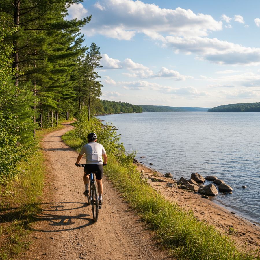
The Ottawa River Pathway
The Ottawa River Pathway provides dedicated cycling infrastructure along sections of the river. The pathway connects parks, conservation areas, and town waterfronts through a combination of paved multi-use trail and on-road cycling routes. The paved sections are smooth and suitable for any bike, while the connecting road segments vary from quiet residential streets to busier county roads with adequate shoulders. The pathway is flat by nature, following the river grade, which makes it accessible to riders of all fitness levels.
Riverside Routes and Back Roads
Beyond the dedicated pathway, the Ottawa Valley's best cycling follows the network of county roads and former highway routes that parallel the river. Highway 17, now largely bypassed by the Trans-Canada freeway, offers stretches of low-traffic pavement with river views. County roads on the south side of the valley wind through a landscape of mixed forest, small farms, and rocky outcrops that reveal the Canadian Shield geology underlying this part of Ontario.
The roads south of the river valley climb gradually into the Madawaska Highlands, where the terrain becomes hillier and more forested. These routes are excellent for riders seeking a challenge, with longer climbs and descents through maple and birch forest. Traffic is minimal once you leave the main corridors. Many of these highland roads qualify among the best scenic rides in the province.
Terrain
The Ottawa Valley's terrain is a transition zone between the flat agricultural lowlands of eastern Ontario and the rugged Canadian Shield to the north. Along the river, the riding is predominantly flat, with gentle grades following the natural river corridor. Move south into the highlands and the terrain changes noticeably, with rocky hills, steeper grades, and roads that wind through gaps in the shield rock. The valley floor roads are excellent for touring cyclists and casual riders. The highland routes demand more fitness and reward with more dramatic scenery.
Road surfaces are generally good on the main county roads. Some of the more remote rural routes in the highlands have rougher pavement or short gravel sections. Gravel bikes and hybrids give you the most flexibility for exploring the full range of terrain.
Best Seasons
The riding season runs from mid-May through mid-October. June is an excellent month, with warm days, moderate humidity, and the river running high from spring melt. July and August are the warmest months, ideal for combining riding with swimming stops at riverside beaches and parks. September brings cool mornings, warm afternoons, and spectacular fall colour as the hardwood forests along the river ignite. The valley's maples are among the first in Ontario to turn, making late September and early October prime time for autumn rides.
Blackflies and mosquitoes are a genuine consideration in late May and June, particularly on routes near standing water and deep forest. Carry repellent and consider a head net for rest stops during bug season. The Ottawa Valley Tourist Association provides current event listings and seasonal travel information.
Planning Your Valley Ride
The Ottawa Valley is more spread out than other Ontario cycling regions. The distance from Arnprior to Petawawa is roughly 130 kilometres by the most direct road route, so plan your days accordingly. Towns are spaced 20 to 40 kilometres apart along the river, providing regular opportunities to resupply. Accommodation ranges from motels and B&Bs in the towns to campgrounds along the river and in the provincial parks. Cyclists looking for longer tours can connect the valley routes with the eastern Ontario cycling region further south.
Cell service is reliable along the river corridor and in towns but can fade quickly on the highland roads south of the valley. GPS devices or downloaded maps are recommended for exploring the back roads. The valley rewards patience and curiosity, and a cyclist willing to spend a few days here will discover a side of Ontario that most visitors never see.