Tay Shore Trail: Midland to Penetanguishene
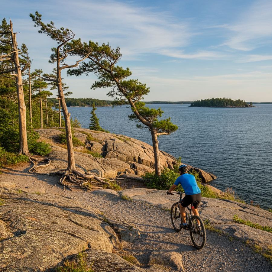
The Tay Shore Trail connects Midland and Penetanguishene along the southern tip of Georgian Bay, running roughly 22 kilometres through one of the most historically rich parts of the province. It is a quieter, more local trail than the Georgian Trail to the west, and that is part of its appeal. You will share the path with dog walkers and retirees on morning rides, not crowds of weekend tourists. The surface alternates between paved sections near town centres and well-packed crushed stone through the more rural stretches, so a hybrid bike or anything with tires wider than 28mm will work well.
Route Details
- Distance: 22 km one way
- Surface: Mixed paved and crushed stone
- Difficulty: Easy / mostly flat
- Family-Friendly: Yes
- Best Season: May through October
- Parking: Trailheads in Midland, Victoria Harbour, and Penetanguishene
The Route
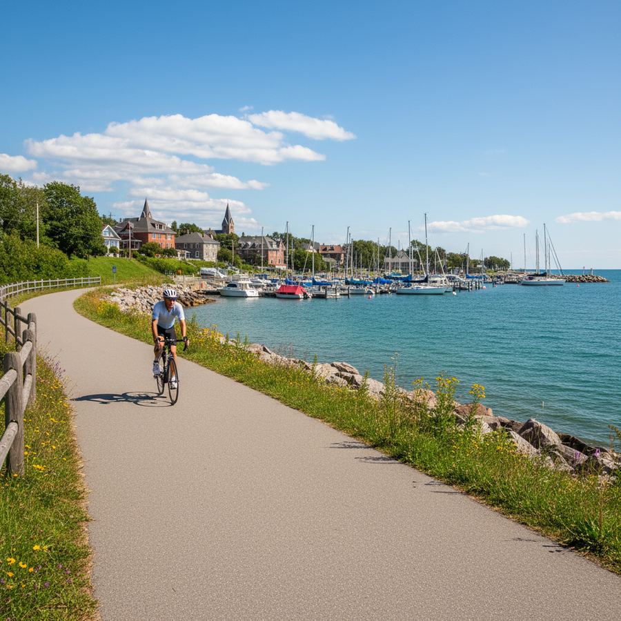
Starting from Midland, the trail heads north along the waterfront before curving west toward Victoria Harbour and then north again toward Penetanguishene. The Midland end is well-developed, with a paved path running through Little Lake Park and along the town's harbour. There are murals painted on buildings downtown depicting the area's history with the Wendat (Huron) people and early French missionaries. You can see some of them from the trail.
Leaving Midland, the surface transitions to crushed stone as the trail follows the old rail corridor. This section runs through a mix of wetlands and light forest, with occasional views of Severn Sound opening up to the east. The grade is gentle throughout. There is one small rise near Victoria Harbour that barely qualifies as a hill, but otherwise this is a flat ride.
Victoria Harbour, about 8 kilometres from Midland, has a small park near the water where you can stop. The town is compact and quiet. From here, the trail continues along the bay's western shore toward Penetanguishene. This stretch has some of the best water views on the route, especially where the trail runs close to the shore between wooded sections.
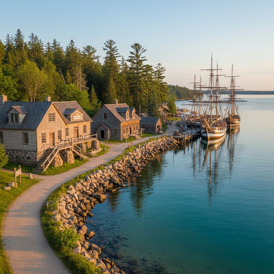
Penetanguishene is the northern terminus. The town sits at the end of a long, sheltered bay and has a distinctly different feel from Midland. It's smaller, more French-influenced (this is one of Ontario's Francophone communities), and has a relaxed waterfront with a few restaurants and a marina. Discovery Harbour, a reconstructed British naval base from the 1800s, is worth a stop if you have time. The tall ships moored in the harbour are visible from the trail as you approach town.
Surface and Bike Choice
The mixed surface is the main thing to plan around. The paved sections in Midland and Penetanguishene are smooth and suitable for road bikes. The crushed stone sections in between are generally well-packed but can get soft after rain, especially in spring. A hybrid, gravel, or mountain bike is the better choice if you want to ride the full length without worrying about conditions.
If you are riding with young children in a trailer, the paved sections work well. The crushed stone sections are manageable but bumpier. Families with kids on their own bikes tend to do fine on the whole trail, as long as the kids are comfortable on loose gravel.
History Along the Trail
This part of Ontario has layers of history that you can actually see from a bike path. Sainte-Marie among the Hurons, a reconstructed 17th-century Jesuit mission, is just south of Midland and accessible via a short detour from the trail. Discovery Harbour in Penetanguishene preserves the British military presence that followed. The Martyrs' Shrine sits on a hill visible from the Midland end of the route.
Even if you skip the formal heritage sites, the landscape itself tells a story. The sheltered bays, the flat terrain, and the proximity to water made this a natural gathering place long before European settlement. Riding through it on a quiet morning gives you a sense of the geography that drew people here.
Connecting to Other Routes
The Tay Shore Trail connects at its southern end to the North Simcoe Rail Trail, which heads south toward Orillia. The connection is not seamless; you will need to ride a short section on local roads through Midland to link up. But it opens the possibility of a longer day ride that covers both trails, giving you roughly 50 kilometres of mostly off-road riding through Simcoe County.
Penetanguishene also serves as a starting point for road rides heading west along the bay toward Tiny Township. The roads out that way are low-traffic and scenic, passing through cottage country with regular views of Georgian Bay.
Practical Details
Midland is about 90 minutes north of Toronto, reachable via Highway 400 and Highway 12. Free parking is available at the Little Lake Park trailhead in Midland and at several points in Penetanguishene near the waterfront. Summer weekends can fill up the Midland lots by mid-morning, so arrive early or park further from the water.
Washrooms are available at Little Lake Park, Victoria Harbour's waterfront park, and Discovery Harbour. Water fountains are less common on the trail itself, so bring a bottle. Midland has a full range of bike shops and services if you need anything before or after your ride.
The trail is maintained by the local municipalities and generally in good condition from May through October. Spring thaw can make the crushed stone sections muddy in April, and fallen leaves can obscure the surface in late October. For trail updates, check the Ontario cycling resources page or local municipal websites.
Who This Trail Is For
The Tay Shore Trail works best for riders who want a manageable, scenic ride with a bit of history mixed in. It is not the longest or most dramatic trail in the Georgian Bay region, but it has a character that the bigger trails sometimes lack. You are riding through real communities, past working harbours and quiet residential streets, alongside water that has been central to this area for centuries. If you are looking for a half-day ride that leaves you feeling like you explored a place rather than just covered distance, this is a strong choice.